Sky watcher I am. My head is either in a cloud or behind a camera. When I can find a way to combine the two, my inner weather geekdom is happy.
The cumulus build-up has been pretty incredible the last few days over forests way to the north. At any rate, this time of the year can be interesting for thunderstorms. I shot this picture while on Hall Road in Santa Rosa this past Wednesday. For those people who are not clear on thunderstorm in the know, the top of the cloud is called an anvil, flattening out when it hits a stable layer of the atmosphere.
Over the Central Plains, a storm would produce this effect, but may build what is called an overshooting top, producing severe weather. We rarely get these types of storms. Oh well, I live vicariously from a distance.
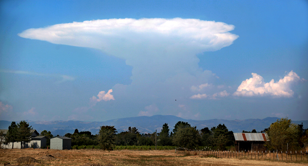
Thunderstorm well to the north of Sonoma County, Wednesday September 14, 2011. (Kent Porter / Press Democrat) 2011
-Kent Porter