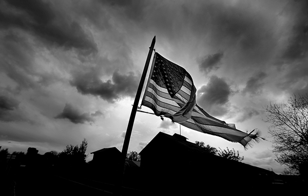
I peruse Sonoma County-and beyond sometimes-in search of scenic weather photos…when I’m not shooting daily assignments. Every once in awhile these two mix and that’s a good thing, nothing beats slopping through hurricane force winds and torrential downpours with a camera in your hands.
Save for a couple of instances, the dramatic skies usually abound this time of year have been painfully absent from Sonoma County environs. I’m not talking sunsets, those have been great by the way, I’m talking those big thunderheads that roam above our landscape, post frontal passage. I get a lot of goodnatured teasing from my photog coworkers at the PD, but I can’t resist a good storm and incredible clouds.
As chocolate or potato chips can be the weak spot of many, storm clouds are my undoing. I admit it, I’m a weatheraholic. That’s right. Go on laugh if you will but my knees buckle for severe weather.
Aside for a few weak (these storms hit the dome of high pressure, chuckle weakly and die) fronts due the next several days, it looks to be high and dry. A web site I visit on a regular basis is the National Weather Service’s Climate Prediction Center page which published these two graphics Sunday morning:
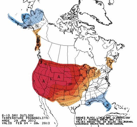
6-10 temperature outlook from Jan 29 2012, Valid from Feb. 4 to Feb. 8 2012
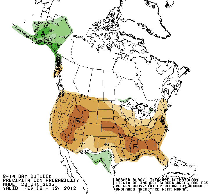
8-14 day precipitation prospect valid from Feb. 6, to Feb.12, 2012
Now the CPC has been spot on with their predictions this year. If you’re a sun worshipper, these graphics point to some pretty nice wx ahead. If you’re like me and go absolutely crazy when a winter sky is clear, this is not a positive indicator for thunderstorm photographics. Not only that, but it seems most of the country will be taking a summer vacation from winter the next couple of weeks.
Red and brown on weather graphics are not optimum signs of impending exposure laden inclemency.
This folks, is a bonafide photographic emergency.
Just Sayin’.
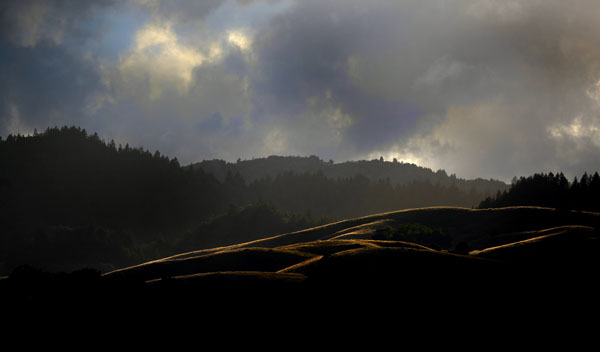
Clearing storm, northern Sonoma County, 2011. Kent Porter weather archives (2011)
-Kent Porter